![Changdeokgung Palace Complex [UNESCO World Heritage Site] (창덕궁과 후원 [유네스코 세계유산])](https://tong.visitkorea.or.kr/cms/resource/03/3092503_image2_1.jpg)
Changdeokgung Palace Complex [UNESCO World Heritage Site] (창덕궁과 후원 [유네스코 세계유산])
2026-02-11
99 Yulgok-ro, Jongno-gu, Seoul
Changdeokgung Palace was the second royal villa built following the construction of Gyeongbokgung Palace in 1405. It was the principal palace for many kings of the Joseon dynasty, and is the most well-preserved of the five remaining royal Joseon palaces. The palace grounds are comprised of a public palace area, a royal family residence building, and the rear garden. Known as a place of rest for the kings, the rear garden boasts a gigantic tree that is over 300 years old, a small pond and a pavilion. The palace gained importance starting from the time of Seongjong, the 9th king of Joseon, when a number of kings began using it as a place of residence. Unfortunately, the palace was burned down by angry citizens in 1592 when the royal family fled their abode during the Imjin War. Thanks to Gwanghaegun, the palace was restored in 1611. Even today, it houses a number of cultural treasures, such as Injeongjeon Hall, Daejojeon Hall, Seonjeongjeon Hall, and Nakseonjae Hall. Changdeokgung Palace’s garden behind the inner hall, called the "Secret Garden," was constructed during the reign of King Taejong and served as a rest area for the royal family members. The garden had formerly been called Bugwon and Geumwon, but was renamed Biwon Garden, or Secret Garden, after King Gojong came into power. The garden was kept as natural as possible and was touched by human hands only when absolutely necessary. Buyongjeong Pavilion, Buyongji Pond, Juhamnu Pavilion, Eosumun Gate, Yeonghwadang Hall, Bullomun Gate, Aeryeonjeong Pavilion, and Yeongyeongdang Hall are some of the many attractions that occupy the garden. The most beautiful time to see the garden is during the fall when the autumn foliage is at its peak and the leaves have just started to fall. Though it has been treasured by Koreans for centuries, Changdeokgung Palace and its complex was recognized as a World Cultural Heritage site by the UNESCO World Cultural Heritage Committee in December of 1997 during the committee meeting in Naples, Italy.

Mudeungsan National Park (Gwangju) (무등산국립공원(광주))
2026-03-25
Geumgok-dong, Buk-gu, Gwangju
Mudeungsan National Park is a mountain park lining the edge of Hwasun-gun, Damyang-gun and Gwangju. Mudeungsan Mountain (1,186 meters) features three rock peaks called Cheonwangbong, Jiwangbong, and Inwangbong, also known as the "Jeongsang Three." Mudeungsan Mountain's gradual slope makes it an easy climb for all. Among the more majestic of these sites are the Seoseokdae, Gyubong, and Ipseokdae peaks. At the base of the mountain are several famous temples including Yaksasa, Jeungsimsa, and Wonhyosa Temples. Mudeungsan Mountain is also known for its beauty throughout the year. The autumn leaves around Gyubongam Hermitage and silver grass of Baengma Ridge are quite spectacular. In winter, snow and ice on the mountain create exquisite scenery as well. Below the mountain, there are a variety of recreational facilities and tourist sites for visitors.
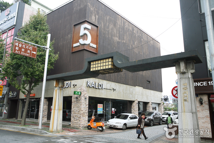
Gwangju Art Street (광주 예술의 거리)
2020-06-19
24, Yesul-gil, Dong-gu, Gwangju
+82-62-942-6160
Gwangju Art Street is aimed at developing Gwangju’s traditional art scene through exhibition of local work. The street is 300m long and located behind Jungang Elementary School, nearby Gwangju Dongbu Police Station. Items commonly found here include Korean fine art such as paintings, ceramics, writings, and industrial art.
Every Saturday, an art flea market famous for its unique pieces is held here. People from all over the nation gather to display items that include old calligraphy materials, collector coins, stone hairbrushes, Chinaware, wooden sculptures, folk drawings, classic books, ink, and incense burners. Part of the attraction is the stories the collectors share with each part of their collection. Enjoy the many shows and exhibitions that draw regular crowds to this famous road.
The Mudeung art exhibit operates according to districts, and functions as a cultural festival as well. The outdoor exhibition was built in February 1995, and is open throughout the day. The large exhibition space has 32 booths and regularly holds special exhibits. Many regional cultural treasures are also on display here. Every Saturday, the Street of Fine Arts is blocked from traffic, and people gather to share and enjoy art culture. Gwangju Summer Universiade will be held this summer, 2015.
![Seonamsa Temple [UNESCO World Heritage] (선암사 [유네스코 세계유산])](https://tong.visitkorea.or.kr/cms/resource/85/3498885_image2_1.jpg)
Seonamsa Temple [UNESCO World Heritage] (선암사 [유네스코 세계유산])
2026-03-27
450 Seonamsa-gil, Suncheon-si, Jeollanam-do
+82-61-754-6250
Seonamsa is a beautiful temple located at the east end of Jogyesan Mountain. The distance between the entrance and the temple site is approximately one kilometer. The temple site is nestled within a lush forest of diverse trees that are hundreds of years old. In front of the temple is an arched stone bridge named Seungseongyo Bridge, which is supported by natural bedrocks. In front of the main hall, Daeungjeon Hall, are two three-story stone pagodas that grab visitors' attention. Not only is Seonamsa Temple home to many of the country's pristine treasures and artifacts, it is also one of the few temples that preserve the traditional temple culture even as of today. Seonamsa Temple is beautiful throughout the year, but it is especially inviting in spring and fall when the flowers start to bloom and tree leaves change in color.

Gyeongbokgung Palace (경복궁)
2026-04-02
161 Sajik-ro, Jongno-gu, Seoul
+82-2-3700-3900
* Special closure on March 21, 2026 Gyeongbokgung Palace was built in 1395 as the official palace of the Joseon dynasty by Yi Seong-gye, the future King Taejo and founder of the new regime. Gyeongbokgung Palace is commonly referred to as the Northern Palace because of its location to the north, comparied to Changdeokgung Palace in the east and Gyeonghuigung Palace in the west. Gyeongbokgung Palace is arguably the most beautiful and is the largest of all five palaces. Many Joseon kings were crowned here. The premises were once destroyed by fire during the Imjin War (1592-1598). However, all of the palace buildings were later restored under the leadership of Heungseondaewongun during the reign of King Gojong. The assassination of Empress Myeongseong, however, resulted in Gyeongbokgung Palace losing its function as a royal palace, eventually witnessing the downfall of the Joseon dynasty. Gyeongbokgung Palace retains the original Gyeonghoeru Pavilion, a prime example of Joseon architecture, and the Hyangwonjeong Pavilion and pond. The sculptures in the Geunjeongjeon Hall exemplify Joseon-era sculpture techniques. The west side of the area outside Heungnyemun Gate is occupied by the National Palace Museum of Korea, while the eastern side of Hyangwonjeong Pavilion within the Gyeongbokgung Palace is occupied by the National Folk Museum of Korea.

Daegu Donghwasa Temple (동화사(대구))
2025-08-11
1 Donghwasa 1-gil, Dong-gu, Daegu
Donghwasa Temple is located on the south side of Palgongsan Mountain, about 22 km northeast of Daegu. It was built by Monk Geukdal in the 15th year of King Soji’s reign (AD 493). The original name of the temple was Yugasa Temple, but Simjiwangsa rebuilt the temple under King Heungdeok (r. AD 826-836) and named it Donghwasa Temple, which means "the paulownia tree blooms even in winter," in reference to the blooming trees around the temple. Most of the present temple buildings were constructed between 1723 and 1732.
Daecheongho Lake (대청호)
2022-12-26
Dong-gu, Daejeon / Munui-myeon, Chungcheongbuk-do
+82-42-251-4748
Daecheongho Lake is a man-made lake, stretching from Daejeon to Cheongju-si, Okcheon-gun, and Boeun-gun. Construction began in 1975 and finished in 1980, and the lake supplies water for various use to people in Daejeon and Cheongju.
The reservoir water spans an area of over 72.8 ㎢ with a perimeter of 80 kilometers, and the water kept in storage has a volume of 1.5 billion tons, making the reservoir the third largest lake in Korea. The area is famous for its beautiful driving course along a tree-lined road through the nearby mountain which has an altitude of 200 to 300 meters. Also, resident birds and migratory birds, such as white heron, can be seen during summer in the upper region of the lake.
Yeouido Park (여의도공원)
2024-04-08
68, Yeouigongwon-ro, Yeongdeungpo-gu, Seoul
Yeouido Park is a large recreational area located on Yeouido Island in the central part of Seoul. It was once originally covered with black asphalt, and people frequented the place for bicycling and roller-skating. The construction began in 1997 and opened officially in February 1999. It is now the place where many people in the city come to rest and enjoy strolling around, playing sports, and cultural events.
Yeongjongdo Island (영종도)
2022-05-12
100, Unnamseo-ro, Jung-gu, Incheon
+82-32-745-0211
Yeongjongdo Island, combined with Yongyudo and Sammokdo Islands through land reclamation work, connects to the mainland via Yeongjongdaegyo Bridge and is located 3 kilometers northwest of Yeonan Pier, Incheon. The 4.42 kilometer-long ride to Yeongjongdo Island provides amazing views of the ocean and mud flats. A fish market is the first thing that greets visitors to the island, providing fresh seafood daily. The island has the Yonggungsa Temple and Baegunsan Mountain, known for its walking trails. At the peak of the mountain, visitors can see a panoramic view of Incheon International Airport.
Soswaewon Garden (담양 소쇄원)
2023-01-04
17, Soswaewon-gil, Damyang-gun, Jeollanam-do
+82-61-381-0115
Soswaewon Garden is a private garden from the Joseon period where Korea's traditional beauty is preserved. It was built by Yang San-Bo (1503-1557) after he gave up his success when his mentor Jo Gwang-Jo (1482-1519) was killed during political strife. Soswaewon Garden presents itself as a clean and transparent garden where the righteous enjoy the life of anbinnakdo (being comfortable amid poverty and taking pleasure in an honest lifestyle) surrounded by a bamboo grove.
Including peach trees, various kinds of trees and grass are planted on both sides of the stream while clear water flows down the foot of the garden walls. The log bridge above the valley adds to the charm of the scenery. The harmony between nature and the artificial waterfall is a sight to behold. Soswaewon Garden is 150 meters away from the main road. Passing through the thick bamboo forest, you will find the small valley and Soswaewon Garden on your left.
 English
 한국어
한국어 日本語
日本語 中文(简体)
 Deutsch
 Français
 Español
 Русский