
Samsung Fashion Outlet - Jeju Nohyeong Branch [Tax Refund Shop] (제일모직아울렛 제주노형)
16.8Km 2024-04-18
22, Doryeong-ro, Jeju-si, Jeju-do
-
Black Yak - Jeju Nohyeong Branch [Tax Refund Shop] (블랙야크 제주노형)
16.8Km 2024-04-17
1F, 25, Doryeong-ro, Jeju-si, Jeju-do
-
Jeju Island Special Tourist Zone (제주도 관광특구)
16.8Km 2024-03-15
Jeju-do
+82-64-740-6000
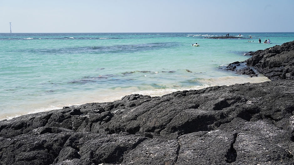
Located to the southwest of the Korean Peninsula, the island of Jeju is Korea's largest tourist destination. The entire island has been designated as a special tourist zone, and it's easy to see why: there is hardly any spot on the island that is not photogenic. Unlike mainland Korea, which has a temperate climate, Jeju boasts a climate that is closer to subtropical. Hallasan Mountain, lying at the center of the island, is surrounded by 368 parasitic cones, known as "Oreum." Eleven beaches have been designated as tourist beaches, but including those that are not officially designated, the island features nearly thirty beaches in total. Famous beaches include Iho Tewoo Beach, Samyang Beach, Hyeopjae Beach, Geumneung Beach, and Gwakji Beach. Jeju's renowned Olle Trails, a system of hiking paths, span a total length of 425 kilometers and would take about fifteen days to complete in their entirety.
![Saengsaeng Pharmacy - Jeju Nohyeong Branch [Tax Refund Shop] (생생약국 제주노형)](http://tong.visitkorea.or.kr/cms/resource/06/2887006_image2_1.jpg)
Saengsaeng Pharmacy - Jeju Nohyeong Branch [Tax Refund Shop] (생생약국 제주노형)
16.8Km 2024-04-18
1F, 1, Wonnohyeongnam 1-gil, Jeju-si, Jeju-do
-
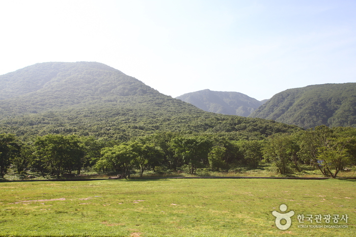
![Hallasan Mountain [National Geopark] (한라산 (제주도 국가지질공원))](http://tong.visitkorea.or.kr/cms/resource/98/2870098_image2_1.jpg)
Hallasan Mountain [National Geopark] (한라산 (제주도 국가지질공원))
16.9Km 2024-12-03
2070-61 1100-ro, Jeju-si, Jeju-do
+82-64-710-3945
Hallasan Mountain stands proudly at the center of Jeju Island and is perhaps the island’s most memorable landmark. Also called Yeongjusan Mountain, meaning "mountain high enough to pull the galaxy," Hallasan Mountain is widely known by scientists for its geological value. Designated as a national park in 1970, there are 368 parasitic cones called "oreum" (Jeju dialect meaning peak) around the main mountain.
Hallasan Mountain is famous for its vertical ecosystem of plants that results from the varying temperatures along the mountainside. Over 1,800 kinds of plants and 4,000 species of animals (3,300 species of insects) have been identified; to explore the mountain's treasures, simply follow one of the well-developed hiking trails.
Hallasan Mountain Trekking (한라산 트레킹)
16.9Km 2020-06-25
2070-61, 1100-ro, Jeju-si, Jeju-do
+82-64-740-6000
Situated on the southern tip of the Korean Peninsula, Hallasan is 1,950 meters in x_height and is the highest mountain in South Korea. Formed from volcanic activity, the mountain is a dormant volcano made mostly of basalt. Home to the magnificent Baekrokdam (lake-filled crater), the mountainside is covered with alpine flora and lush trees.
The mountain is characterized by majestic cliffs, steep slopes, interesting rock formations, and, in particular, myriads of colorful azaleas. There are over 360 small mountains (uniquely-shaped volcanic mountains called “Oreum” in Jeju dialect) surrounding Halla Mountain that offer new delights to visitors with the coming of each new season. Along with Hallasan, the oreums were officially named the Hallasan Natural Protection Area (Natural Monument No.12) in 1966.
There are six hiking trails along Hallasan. Seongpanak Trail on the east and Gwaneumsa Trail in the north go all the way up to the summit (Baekrokdam). Those looking for a less rigorous hike are advised to take the shorter trails reaching midway up the mountain. All trails are relatively short (less than 10 kilometers) and can be hiked in less than a day. Visitors are advised, however, to start early in the morning if planning on hiking up to the summit and to check official operating hours, as some trails are only open during certain hours of the day. Keep reading for information on some of the most popular trails.
* Gwaneumsa Trail (North)—Summit Trail
Gwaneumsa Trail offers hikers the best view of Hallasan’s deep valleys and stunning terrain. Midway along the trail is Guringul (a lava cave) and Tamna Valley. Tamna Valley is especially beautiful during the fall when the leaves are changing and during the winter when the entire area lays under a dusting of snow.
* Seongpanak Trail (East)—Summit Trail
This relatively long, gently sloping trail is perfect for beginners. Lush broadleaf trees give shade from the beating sun and in spring the azaleas bloom and turn the mountainside into a dazzling array of color.
* Eorimok Trail (Northwest)
This short trail is another relatively easy trail for beginners. In spring, the nearby meadows are adorned with red royal azaleas. From the stone pathway to Mansedongsan visitors can catch a breathtaking panoramic view of the countryside and the island’s signature Oreums.
* Yeongsil Trail (Southwest)
As the shortest trail in Hallasan, this trail boasts Yeongsilgiam (a spectacular cliff with series of unusual rock formations). It is covered with azaleas and royal azaleas in spring and vibrant autumn foliage starting in October.
![E-Mart - Sinjeju Branch [Tax Refund Shop] (이마트 신제주)](http://tong.visitkorea.or.kr/cms/resource/09/2887009_image2_1.jpg)
E-Mart - Sinjeju Branch [Tax Refund Shop] (이마트 신제주)
16.9Km 2024-04-23
3348, 1100-ro, Jeju-si, Jeju-do
-
Cheongdam Rui Plastic Surgery [Tax Refund Shop] (청담루이성형외과)
16.9Km 2024-04-23
14, Nohyeong 14-gil, Jeju-si, Jeju-do
-

Baengnokdam Lake (한라산 백록담)
17.0Km 2022-07-13
Topyeong-dong, Seogwipo-si, Jejudo
+82-64-713-9950
Baengnokdam is a crater lake that sits on top of Hallasan Mountain at the center of Jeju Island. It spans 3 kilometers in circumference and 500 meters in diameter, and is surrounded by approximately 360 parasitic cones. At the peak, visitors can feel like floating on clouds.
Conan Beach (코난해변)
17.0Km 2024-11-18
575-6 Haengwon-ri, Gujwa-eup, Jeju-si, Jeju-do
◎ Travel information to meet Hallyu’s charm – variety show “EXchange / Transit Love 3”
 English
 한국어
한국어 日本語
日本語 中文(简体)
 Deutsch
 Français
 Español
 Русский