
Gogeunsan Mountain (고근산)
17.9Km 2021-06-14
Gogeunsan-ro, Seogwipo-si, Jeju-do
+82-64-740-6000
Located near Seogwipo-si on Jeju Island, Gogeunsan Mountain (altitude of 396 m, relative x_height of 171 m, a circumference of 4,324 m) is a parasitic cone volcano and an oreum with a shallow crater on the top. Although it is not high in elevation, its expansive presence offers outstanding views overlooking nearby areas including Marado Island and Jigwido Island.
The mountain is also an ideal location to go for an evening stroll to enjoy the nightscape of the sea and Seogwipo Chilsimni.
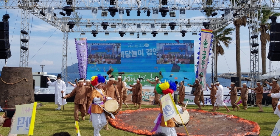
Seogwipo Chilsimni Festival (서귀포 칠십리축제)
17.9Km 2024-10-14
33 World cup-ro, Seogwipo-si, Jeju-do
+82-64-760-3942
Seogwipo Chilsimni Festival keeps the local traditions and customs of the Seogwipo area alive and provides an active and festive experience for all who visit.
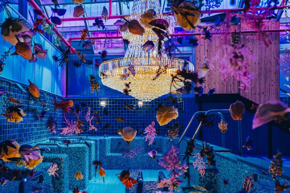
Jeju Waterworld (제주워터월드)
17.9Km 2025-03-19
33 World cup-ro, Seogwipo-si, Jeju-do
Jeju Waterworld is Korea's first media park themed on water. The leisure park is divided into 12 themed areas that offer a wide range of media art and content for unique fun. The facility is accessible all year round as it uses warm water in fall and winter. It is a family-friendly theme park packed with fun for all ages.
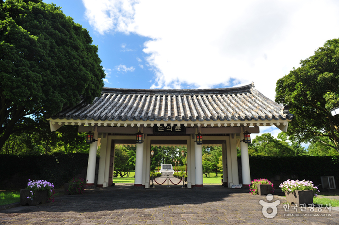
Historic Site of Anti-Mongolian Struggle in Hangpadu-ri, Jeju (제주 항파두리 항몽 유적)
18.0Km 2022-08-18
50, Hangpaduri-ro, Jeju-si, Jeju-do
+82-64-710-6721
Historic Site of Anti-Mongolian Struggle in Hangpadu-ri is where the Sambyeolcho military unit of the Goryeo dynasty resisted the invasion of Mongolia until the last possible moment. The site houses an
exhibition hall, a monument, and a unique mud fortress. Nearby is Jangsumul Spring (Jangsu means general) which flowed from the footprints of General Kim Tong-jeong. Today, water from the spring
cannot be used as drinking water.
Sambyeolcho was a military unit of the Goryeo dynasty. When the Goryeo dynasty made peace with the Mongolian forces in February 1270 (the 11th year of King Wonjong), the Sambyeolcho special defense unit opposed it and launched a resistance movement. They moved their base to Jindo in Jeollanam-do, but after suffering a huge defeat, they moved to Jeju-do and built Hangpaduseong Fortress. They continued to fight against the Mongolian forces for two more years there. However, all the members were killed in April 1273 (the 14th year of King Wonjong).
This independent anti-Mongolian movement was born out the deeply patriotic belief in the need to safeguard the nation from foreign invasion. In 1977, the government invested 745 million won to restore part of the fortress and build a monument in commemoration of those who died in the war. The work was completed in June 1978.
GS25 - Seogwipo Terminal Branch [Tax Refund Shop] (GS25서귀터미널점)
18.0Km 2024-06-27
9213, Iljudong-ro, Seogwipo-si, Jeju-do
-
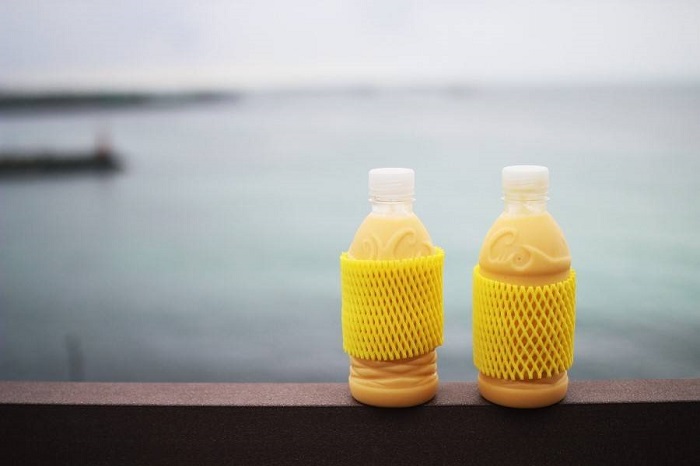
Richimanggo - Aewol Branch (리치망고 애월)
18.0Km 2021-03-24
272, Aewolhaean-ro, Jeju-si, Jeju-do
+82-70-4243-5959
You can enjoy a mango drink while looking at the beautiful scenery. The best menu at this restaurant is mango juice. This cafe is located in Jeju-si, Jeju-do.
E-Mart - Seogwipo Branch [Tax Refund Shop] (이마트 서귀포)
18.1Km 2024-04-16
9209, Iljudong-ro, Seogwipo-si, Jeju-do
-
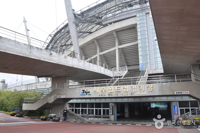
Jeju World Cup Stadium (제주월드컵경기장)
18.2Km 2021-02-02
33, World cup-ro, Seogwipo-si, Jeju-do
+82-64-760-3623
Jeju World Cup Stadium was uniquely built 14 meters below ground level to allow for a beautiful green field all year round. The stadium allows for panoramic views of Jeju's outstanding nature, including Hallasan Mountain and many islands dotting the sea around Jeju.
![Hallasan Mountain [National Geopark] (한라산 (제주도 국가지질공원))](http://tong.visitkorea.or.kr/cms/resource/98/2870098_image2_1.jpg)
Hallasan Mountain [National Geopark] (한라산 (제주도 국가지질공원))
18.2Km 2024-12-03
2070-61 1100-ro, Jeju-si, Jeju-do
+82-64-710-3945
Hallasan Mountain stands proudly at the center of Jeju Island and is perhaps the island’s most memorable landmark. Also called Yeongjusan Mountain, meaning "mountain high enough to pull the galaxy," Hallasan Mountain is widely known by scientists for its geological value. Designated as a national park in 1970, there are 368 parasitic cones called "oreum" (Jeju dialect meaning peak) around the main mountain.
Hallasan Mountain is famous for its vertical ecosystem of plants that results from the varying temperatures along the mountainside. Over 1,800 kinds of plants and 4,000 species of animals (3,300 species of insects) have been identified; to explore the mountain's treasures, simply follow one of the well-developed hiking trails.
Hallasan Mountain Trekking (한라산 트레킹)
18.2Km 2020-06-25
2070-61, 1100-ro, Jeju-si, Jeju-do
+82-64-740-6000
Situated on the southern tip of the Korean Peninsula, Hallasan is 1,950 meters in x_height and is the highest mountain in South Korea. Formed from volcanic activity, the mountain is a dormant volcano made mostly of basalt. Home to the magnificent Baekrokdam (lake-filled crater), the mountainside is covered with alpine flora and lush trees.
The mountain is characterized by majestic cliffs, steep slopes, interesting rock formations, and, in particular, myriads of colorful azaleas. There are over 360 small mountains (uniquely-shaped volcanic mountains called “Oreum” in Jeju dialect) surrounding Halla Mountain that offer new delights to visitors with the coming of each new season. Along with Hallasan, the oreums were officially named the Hallasan Natural Protection Area (Natural Monument No.12) in 1966.
There are six hiking trails along Hallasan. Seongpanak Trail on the east and Gwaneumsa Trail in the north go all the way up to the summit (Baekrokdam). Those looking for a less rigorous hike are advised to take the shorter trails reaching midway up the mountain. All trails are relatively short (less than 10 kilometers) and can be hiked in less than a day. Visitors are advised, however, to start early in the morning if planning on hiking up to the summit and to check official operating hours, as some trails are only open during certain hours of the day. Keep reading for information on some of the most popular trails.
* Gwaneumsa Trail (North)—Summit Trail
Gwaneumsa Trail offers hikers the best view of Hallasan’s deep valleys and stunning terrain. Midway along the trail is Guringul (a lava cave) and Tamna Valley. Tamna Valley is especially beautiful during the fall when the leaves are changing and during the winter when the entire area lays under a dusting of snow.
* Seongpanak Trail (East)—Summit Trail
This relatively long, gently sloping trail is perfect for beginners. Lush broadleaf trees give shade from the beating sun and in spring the azaleas bloom and turn the mountainside into a dazzling array of color.
* Eorimok Trail (Northwest)
This short trail is another relatively easy trail for beginners. In spring, the nearby meadows are adorned with red royal azaleas. From the stone pathway to Mansedongsan visitors can catch a breathtaking panoramic view of the countryside and the island’s signature Oreums.
* Yeongsil Trail (Southwest)
As the shortest trail in Hallasan, this trail boasts Yeongsilgiam (a spectacular cliff with series of unusual rock formations). It is covered with azaleas and royal azaleas in spring and vibrant autumn foliage starting in October.
 English
 한국어
한국어 日本語
日本語 中文(简体)
 Deutsch
 Français
 Español
 Русский